
Salem ZIP Code Coverage
Virginia’s official DMV locality table associates Salem City, locality code 51775, with 24153, 24155, and 24157. A later effective-date row also shows 24018 with the Salem locality. This is useful Salem state-administrative evidence, but it is not a USPS boundary file. The research did not locate an official Salem street-by-street neighborhood or facility assignment for 24155 and 24157. The Salem ZIP code directory therefore keeps the confirmed association separate from anything not yet officially mapped.
| ZIP Code | Areas Covered | Post Office | Notes |
|---|---|---|---|
| 24153 | Primary Salem mailing code; the DMV table associates it with Salem City. | Salem Post Office, 320 W Main Street. | Use exact-address USPS lookup and Salem GIS because the postal area can reach beyond city limits. |
| 24155 | Associated with Salem City in the DMV locality row. | Unique facility and preferred-city boundary not located in official sources reviewed. | Verify through USPS Cities by ZIP and the exact street address. |
| 24157 | Associated with Salem City in the DMV locality row. | Unique facility and preferred-city boundary not located in official sources reviewed. | Use USPS Cities by ZIP, then check the city-limits layer. |
| 24018 | Appears in a later effective-date DMV row associated with Salem locality. | Not established here as a Salem-only postal facility. | Possible postal or locality overlap, not proof of municipal residence. |
The confirmed postal anchor is the Salem Post Office at 320 W Main Street, ZIP 24153-9998. The official location page lists weekday and Saturday counter hours, PO Box access, and delivery information. That facility is strong evidence for the 24153 postal route, but it does not define every parcel within the city.

The post-office capture supports a postal lookup decision, while a municipal boundary still requires the GIS City Limits layer.
The Salem location page identifies delivery Monday through Saturday and 24-hour PO Box access. Those details may help explain a Salem mailing label or a box number in a family file, but the postal facility is not a property-record custodian. For a current Salem parcel, Salem’s Real Estate Department remains the city route. For an older Salem tract, the date may require a Roanoke County land or court path. The Salem ZIP code directory is the first sort, not the final records decision.
Salem ZIP Code Directory Choices
For Salem, USPS ZIP Lookup offers three useful modes. By Address accepts a street with city and state, or a street with ZIP. By City and State returns codes associated with that postal city. Cities by ZIP works in reverse when the code is already known. USPS cautions that a result does not confirm a person or company at an address. Read its answer as Salem mailing-format evidence, then preserve the returned postal city and lookup date.
| USPS lookup mode | Input | What to save for Salem research |
|---|---|---|
| By Address | Street plus city/state, or street plus ZIP. | Formatted delivery address, ZIP, ZIP+4 if displayed, and lookup date. |
| By City and State | Postal city and state. | Every returned ZIP, not only the one expected from a prior record. |
| Cities by ZIP | ZIP code. | Returned postal city information, then a separate municipal check. |
Use the ZIP code directory as a Salem reconciliation tool when an old directory, letter, obituary, or public filing uses a Salem mailing label. It cannot turn a ZIP result into a named-neighborhood list. The official Salem research deliberately leaves that gap open until USPS or a local GIS boundary identifies it.
Postal accuracy and municipal accuracy can both be true while answering different questions. A correct USPS format tells a sender how the address is delivered. The Salem GIS address point and City Limits layers tell a city researcher how the place is represented in current municipal geography. A parcel’s legal description and deed reference answer a third question about the land. Record all three when a historic source must be connected to a modern location. Do not replace an older county label simply because USPS now returns Salem.
Search Salem ZIP Code Records
There is no official Salem ZIP-wide parcel or resident result set in the sources reviewed. The DataScout property page describes ownership, characteristics, mapping, and sales statistics, but it does not document a ZIP filter. Salem GIS documents address, street-name, and tax-ID search, not ZIP search. That limitation matters: a postal code narrows a mailing question, but the next local record search normally needs an exact address, street, tax ID, or parcel.
- Run USPS By Address when the street is known, or By City and State when only the postal city is known.
- Record the ZIP exactly as returned, including ZIP+4 if the result displays it, and do not treat it as a person finding.
- Open Salem GIS with the actual address, street name, or tax ID to check the City Limits and Address Points layers.
- Use the parcel result, land book, directory, or court route only for the narrower record question and label the resulting role.
Once the ZIP narrows an inquiry to a real street, the Salem Street Directory supplies the address-centered sequence through GIS, plats, land books, and deeds. It is more reliable than treating a postal route as a block boundary. A voter record is also not a ZIP-wide public roll: the one-person portal uses protected inputs, while broader list products have statutory client and distribution limits.
Note: Save the ZIP field, postal city, municipality, jurisdiction, and lookup date separately so later comparisons do not flatten distinct records.
Salem GIS can still add useful geographic context after an address result. Its public tools list parcels, Address Points, City Limits, Tax Map Grid, roads, buildings, zoning, polling, school, flood, cemetery, annexation, and historic-map layers. They are not ZIP search controls. The right workflow is to obtain the postal result first, then submit the actual address, street name, or tax ID to GIS. A data point that is near a ZIP boundary should be checked against the layer date and map disclaimer before it is paired with an older directory or deed.
Salem GIS Fields After ZIP
After USPS returns a Salem postal result, Salem GIS provides the documented local inputs for testing the actual place. The city lists address, street-name, and tax-ID searches, not a ZIP-wide control. That distinction prevents a Salem ZIP code directory from implying a property or resident filter that the city has not published. Record the query form and map date with the result.
| Salem GIS field or layer | Documented use | ZIP research role |
|---|---|---|
| Address | Find a civic address on the map. | Checks the specific USPS-formatted address. |
| Street name | Locate a named street. | Provides a route when a historic Salem label lacks a current number. |
| Tax ID | Locate a mapped tax parcel. | Connects a known parcel to City Limits and address-point geography. |
| Address Points and City Limits | Public GIS layers confirmed by the REST service. | Tests municipal representation after the ZIP result. |
Salem GIS describes graphic map data, not survey evidence, and updates as needed, typically Friday mornings. A Salem ZIP result plus a city-limits layer is stronger than either source alone, but a deed or land book may still be needed for the historic jurisdiction.
Salem ZIP Evidence Gaps
The official research confirms that 24155 and 24157 appear in the Salem DMV locality row, but it did not locate a public official facility assignment or complete named-area boundary for either code. It also did not locate a Salem assessor or GIS ZIP-wide result page. Keep those gaps visible in a Salem ZIP code search instead of turning an administrative association into a precise postal or municipal boundary.
Use USPS Cities by ZIP and By Address for the exact street, then compare the returned postal city with the Salem City Limits layer. If a map or postal page does not answer the question, preserve the unresolved result and ask the appropriate custodian for a current boundary or delivery clarification.
Salem ZIP Code Search Limits
The Virginia State Police registry is one official portal that explicitly supports Salem ZIP, address, city, county, radius, map, and contiguous-area modes. Its ZIP function is unusually granular, yet it is a statutory public-safety registry, not a general Salem resident index. A Salem ZIP result requires checking the displayed name, photograph, registry number, address information, and update date directly with the agency. It does not establish that every listed person currently lives within Salem municipal limits.
The Virginia State Police registry capture shows the ZIP-capable public search route.
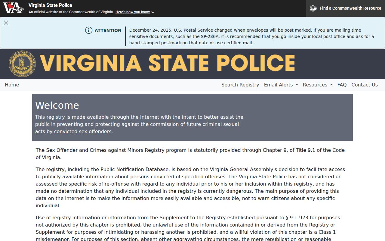
Keep that portal within its stated public-safety purpose and use Salem GIS for geographic confirmation rather than repurposing it as a neighborhood directory.
Search mode alone does not define the meaning of a result. The registry permits ZIP, city, county, address, and radius or map queries because its governing purpose is public safety. Salem DataScout and GIS do not publish a corresponding ZIP-wide resident search mode in the research reviewed. That difference should be visible in a ZIP code directory: an available filter is not permission to convert a specialized public record into an unrelated mailing list or neighborhood roster.
Salem ZIP Code Boundaries
ZIP codes are delivery routes and service areas. Salem City Limits are municipal geography. The two systems can overlap without matching. A ZIP-only historic source may say Salem, a current parcel may lie in an adjacent jurisdiction, and a pre-1968 record may use Roanoke County for a tract that is now in Salem. Check the city-limits layer after USPS, then keep the original jurisdiction label on the older record. The sequence is postal result, GIS boundary, parcel or map context, and dated source.
- ZIP and ZIP+4
- A five-digit ZIP identifies a postal delivery area. ZIP+4 adds a more specific delivery segment when USPS displays it.
- PO Box ZIP
- A ZIP used for post-office box delivery. It should not be treated as a physical parcel location.
- Unique ZIP
- A ZIP associated with one organization or high-volume recipient. No Salem-specific unique ZIP is established here.
- Carrier route
- A postal delivery grouping used by a carrier. It is not a city boundary or a public resident list.
Geography check. A Salem ZIP code can validate postal formatting, but only the current GIS City Limits layer can test whether the address is within the independent city.
When an address is historic, ask four separate questions: what did the source call the postal city, what ZIP was used if any, what local government had jurisdiction at the time, and which boundary layer is being used today? Salem’s independent-city transition and earlier Roanoke County trail make this especially important. A postal result can be accurate without identifying the former court, land-book, or archival custodian. That is why the date travels with every ZIP code result.
Salem Postal Geography Over Time
Salem postal labels need a date. Salem became an independent city at the end of 1967, with its present charter in 1968, while older land and household records often remain under Roanoke County. South Salem was annexed in 1953 and an eastern tract in 1960. These changes explain why a historic source can have a Salem postal reference alongside a county jurisdiction. They do not authorize changing the original record label to make it look modern.
For a Salem family-history search, preserve the address as printed, then note its postal city, ZIP if present, municipal or county jurisdiction, and year. This approach lets a Salem ZIP code directory support the paper trail without overstating what Salem postal geography can prove.